Crossing Southern New Mexico
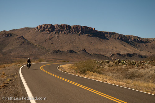
Over the past few weeks, we have been zipping across Southern New Mexico. There is a lot of vast nothingness – wide open land, small towns, high desert landscape – in between a few larger cities, and it’s really easy to just pedal, pedal, pedal to get to the next camping spot or homestay, because there’s really not a whole lot to stop and explore (unless we were to go hiking, which is kinda tough with the bikes). We’re also getting bombarded with some serious winter out here, supposedly the coldest and wettest winter ever (or so we keep hearing from locals again and again), so we’re eager to get down to some lower elevations and (hopefully) warmer temperatures. But, don’t get me wrong… it’s beautiful country out here!

From Deming, we headed East to Las Cruces. For the first 15 or so miles, we followed Highway 549. This is a great small highway with low traffic volumes and wide open landscapes. It’s also where we met Patrick, who is running across the US! We had stopped for a snack and were surprised to see someone coming toward us on a bicycle. It turned out to be Patrick’s grandfather, who told us about his grandson’s project and that he was following him to Texas in an RV. We caught up with Patrick a few miles up the road and had a chance to hear more about his run. He’s headed straight out to Georgia over the next couple months, so keep an eye out if you’re on his route. Good luck Patrick!

We left Patrick and his grandfather and continued on to Las Cruces. Highway 549 ends and we were forced to hop on I-10. Not particularly pleasant, but not terrible either. We put on some music and just kept pedaling. In Las Cruces, we spent two days with our hosts, Lisa & Jacob. We swapped lots of stories (Lisa used to ride in a lot of 24- and 48-hour mountain bike races!), got a tour of town, and rested up.
From Las Cruces, we headed up and over San Augustine Pass toward White Sands. The climb itself is fairly easy, as you slog 10 or so miles at 1-2% (along a frontage road) and tip upward at 6% for just 3 miles. Lisa and Jacob had told us that it was wonderfully flat on the other side of the climb, but had neglected to mention that you get to go down first! (Considering that we still haven’t gone down after crossing the Continental Divide, Russ and I just assumed we were climbing up to another plateau.) It’s a screaming downhill, straight and fast, for several miles. And then you continue on for another several more miles to get to White Sands.

After our crazy White Sands camping experience, we were up and out quite early in the morning. We roamed around the park, continually forgetting that the white stuff is sand and not dirty snow (the cold that morning wasn’t helping!). We met our next homestay host, Michael, as he rolled through the park on a training ride. And then we set out for a leisurely ride into Alamogordo.
We ended up staying in Alamogordo for several days (thank you Michael!!). Yet another storm blew through and dumped rain and snow, and we were delighted to wait it out indoors. We spent that time swapping stories with Michael and discussing everything from the allure of the day-job to our society’s food habits to the effect of the economic slump on Boomers to tips from ultra-distance racing that we can apply to our travels to how we can make this trip self-sustaining.

From Alamogordo, we psyched ourselves up for a long, hard climb and headed up Highway 82 to Cloudcroft. The road to Cloudcroft climbs for approximately 14 miles, gaining approximately 4500 feet of elevation. In other words, it’s a heck of a lot of work! There isn’t much of a shoulder on the road and, unfortunately, we rode up on Saturday, so there was a lot of traffic, but most drivers were nice enough to just go around. Somewhere around 6500 feet, we started feeling the effects of the elevation. Neither of us was expecting it, especially so early, but we’re not anywhere close to used to that kind of elevation (our apartment in Long Beach, after all, was at about 100 feet above sea level). Sleepiness, headaches, not able to focus particularly well – it made those last few miles quite interesting to climb. And by the time we got to the top, not only was it the highest point we’ve ever been on our bikes, it was the longest continual climb we’ve done! Whew.


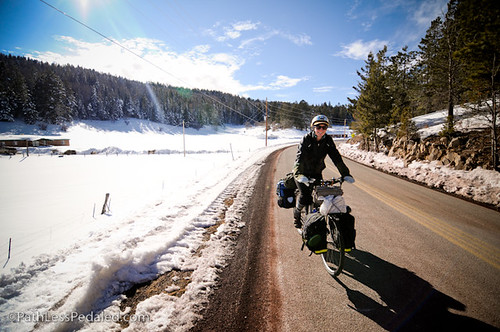
We rolled into the little town of Cloudcroft, got some coffee and hot chocolate, and sat down for awhile to rest, enjoying the fact that we were surrounded by snow. An hour later, warmed up, hydrated, fed, and not nearly as exhausted, we pushed off again toward Mayhill, a small community where our next homestay is located. From Cloudcroft, we took Highway 130, a smaller road with much less traffic. And, wow, what an incredibly beautiful ride! This road absolutely made up for the difficulty of the climb. Highway 130 climbs a few more hundred feet from Cloudcroft, then sends you downhill for 18 or so miles. You wind along small ranches and farms, following a small river. The snow from the last round of storms was thick on the ground, blanketing the trees and houses and cars. Cows and horses grazed in the snowy fields, while ducks and wild turkeys drank from the river. It was an absolute winter wonderland, and astonishingly beautiful.

Our plan was to capture the downhill on video to share with you all. And when we met some cows in the road and had turkeys fly right in front of us, we were delighted that we could share all of that too. Until we tried to download the footage and realized the camera had malfunctioned and didn’t actually record. (Boo!) But, trust us that it was incredible, and plan to come out here for yourself the next time it snows hard.

In Mayhill, we have had the opportunity to stay with Betsy and Rob, a couple from Phoenix who had moved out to the country a little over a year ago. Outdoors people for their entire lives, this 86-acre chunk of ranchland is a dream come true, and they’re finishing building a new house that is completely off-the-grid. Powered by solar panels, our simple living and tiny house friends would be enthralled by this small, simple house with amazing views and actual tree branches holding up the edge of the second floor.

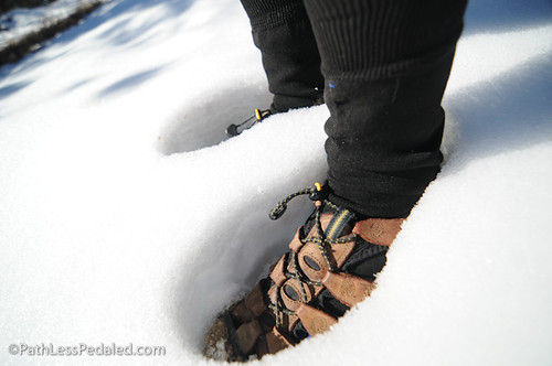
We took full advantage of the opportunity of our stay with Betsy and Rob and traipsed around their snow-covered orchard, cow pasture, and tree-dotted hills.


From Mayhill (where we are at this moment), we’re headed down the hill toward Artesia and Carlsbad, where we anticipate getting socked by yet another storm. Then it’s south to Texas!
11 Comments
Leave a Reply
This site uses Akismet to reduce spam. Learn how your comment data is processed.
Subscribe
Patreon
Join Team Supple on Patreon
PayPal

Come on down ya’ll! Texas is ready for you!!
We just returned from 4 month trip from London to Spain.
The weather in Catalunya was very cold, and it was one of the markers for us to head back home.
Seeing you riding in harder conditions then us, with all the snow around you. hehe.
We salute you!
Good luck and keep warm 😉
Kfir
Thanks Kfir. These cold days are really starting to wear on us but we are trying to push through. Looks like we’re going to be hit with another storm the next few days. Ack!
…but are they ready for Texas?
Looking forward what route through Texas are you taking?
Wow what an adventure. Sounds very exciting and challenging!
Wow! That is quite a ride. Traveling through New Mexico there is a lot of “nothingness” but it is beautiful country.
You guys are very impressive! The fortitude you display is inspiring. Sorry we don’t get to see the video of the downhill, but the description is a good substitute.
I spent two weeks backpacking in northern New Mexico as a teen. Took Amtrak from LA to a town called El Raton. Years later I made this trip in a car. This has got to be one of my favorite places in the world.
are there at least gas stations ???
Hi Patty – The small town of Rodeo, at the Arizona/New Mexico border has a very very small market (that I think I remember closed around 3pm). Between there and Columbus, New Mexico (about 90 miles), there’s only one small mini-mart. No gas stations or anything else. It really is that desolate.