
Video Review: Maplets
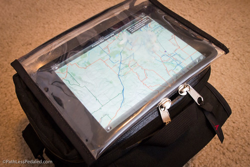
As some Facebook fans know, I just got an iPad Mini and have been nerding out on it. One of my favorite apps so far is Maplets. It lets you find and download regional paper maps! It’s great for touring or if you’re visiting another city/town and want to see their local transit/walk/bike map. It has lots of great features, like the ability to take notes on maps, draw paths and even supports GPS. Check out how it’s used in the video below!
(Keep our adventures going and the site growing! If you’ve enjoyed our stories, videos and photos over the years, consider buying our ebook Panniers and Peanut Butter, or our new Brompton Touring Book, or some of the fun bike-themed t-shirts we’re designing, or buying your gear through our Amazon store.)
I got Maplets for my iPod Touch before my last tour, and it was super-useful!
nice! i have ‘ride the city’ and ‘bike maps’ but this is way better.
Great review.
And the cool thing is that if you’re using an iphone, it will show you exactly where you are, even if there’s no signal in the area.