
Phillips Lake, Oregon to Hell’s Gate, Idaho
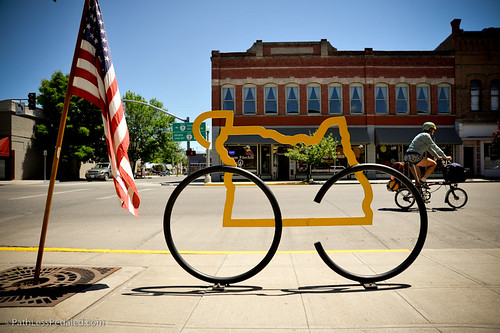
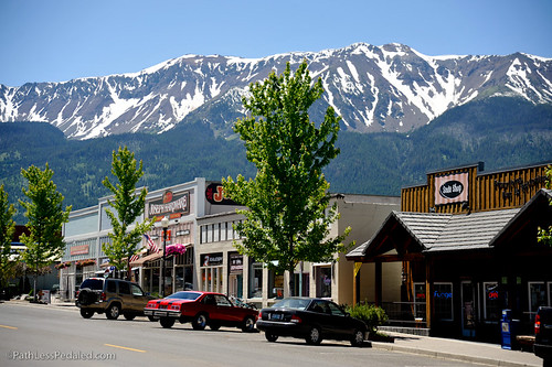
Waking up at Phillips Lake, we were still grateful that they had found space for us. We were headed into Baker City for a few days, just a short 20 mile ride from the lake, so we were able to take our time getting out of camp and enjoy the beautiful spot. Baker City was just waking up when we rolled into town, and we poked around the few places that were open that Sunday morning of 4th of July weekend. Ice cream, coffee, and then we set off to find our warmshowers hosts for the night. We pitched our tent in their beautiful backyard, cleaned off for the first time in a few days, and then found our way to Paizano’s (a local pizza spot, recommended by a reader). We polished off an entire (delicious!) pizza and a few beers while catching up online and enjoying the air conditioning. After pizza, we went in search of a rumored Airstream rally, and found a dozen or so gleaming trailers parked in a circle in the city park. We chatted with a few Airstreamers (who were there celebrating Wally Byam’s birthday, the inventor of the Airstream), and even got a tour of a few trailers. That night, we went to sleep to the sound of fireworks being shot off around the neighborhood.
Since we rolled into Baker City on the holiday, we decided to stay around town for a few days until the city returned to “normal” hours and we could actually explore some of the shops and restaurants. So, the next few days were filled with coffee at Bella, singing Happy Birthday to Wally Byam with the Airstreamers, interviewing folks about bike advocacy in Baker City, attempting to watch fireworks from the hotel balcony, drinking local brews at Barley Brown’s, and checking out the many shops in the historic downtown.
Leaving Baker City, we headed east on Hwy 86. About 6 miles out of town, we stopped at the Oregon Trail Interpretive Center. It had been highly recommended that we stop, although we were wary of the steep steep climb up to the museum. As it turned out, it was one of the best educational centers we’ve been to, and full of fascinating information about the Oregon Trail (from the perspective of the pioneers, as well as the Native Americans). One of our favorite parts was learning that most pioneers considered bacon to be an essential part of their pantry, and would plan for roughly 100 pounds per person! From the Oregon Trail Center, we rambled onward through the sweltering heat, thankful that we weren’t roughing it as much as the pioneers. In Richland, we stopped for ice cream and burgers, and then hid out in the library for a few hours, enjoying their free Internet and air conditioning. We decided to camp at the county park just outside of town. Their showers were crazy expensive, but the location was beautiful.
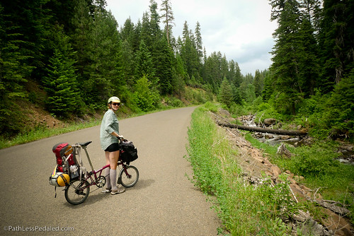
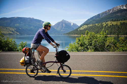
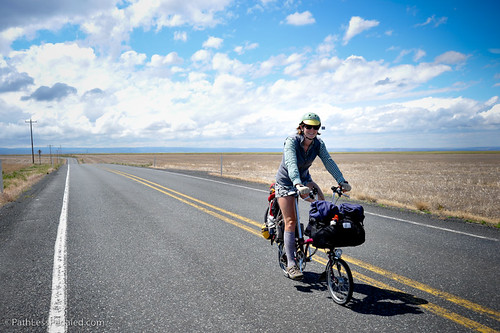
The next morning, we woke up to cloudy skies, which meant that we would have some reprieve from the sweltering heat during all the climbing that was ahead of us. We had decided that we really wanted to see the town of Joseph and Wallowa Lake, so we departed the TransAm after the small town of Halfway, and we headed up Rte 39. But, first, we had to stop in Halfway. We stumbled into Levi’s (on their first day!) and devoured the most delicious plates of brisket hash. Rte 39 turned out to be one of the most fantastic roads for cycling, although almost all of the elevation information we had beforehand was wrong. It’s a narrow road, so there’s very little traffic, and the scenery is spectacular. From the south side, you climb almost 3000 feet to a summit of roughly 5300 feet, over a distance that feels like practically forever. As we pedaled our way uphill, a thunderstorm slowly rumbled its way across the sky and brought some moisture and cooler temperatures. And, eventually, we reached the top (a very unassuming summit, with no signs), and suddenly started screaming downhill. We had hoped to get out to the Hell’s Canyon overlook, but we were exhausted when we reached the turnoff and nearly out of water, so we just couldn’t bring ourselves to log an extra 6 miles and several hundred feet of climbing. Instead, we enjoyed the downhill, and pulled into Ollicott campground, along the Imnaha River. We chose it because it was the only campground along the whole route with a well and drinking water. And once we figured out the strange well and tasted the water (full of minerals!), we ended up just getting water from our very generous neighbors. The Imnaha was absolutely raging, full of snow melt, and provided a lovely soundtrack to fall asleep to.
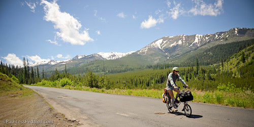
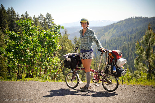
From the campground, we expected a few rolling hills into Joseph. Man, were we wrong! You go down, then you go up, and up, and up, to almost 6000 feet. Then you go down just a little, ramble around a ridge, and go up to almost 6100 feet. Exhausted and almost out of snacks, we finally reached the summit (thankfully, there was a sign this time, indicating we had actually found the top). The road wound around the north side of the snow-capped mountains, giving us the most breathtaking descent. At the bottom, there was one final hill to climb and then a headwind to fight to get into Joseph. By the time we rolled into town, we were thoroughly worn out. But we were also ever-so-glad that we had decided to take the detour. Rte 39 was a fantastic experience and Joseph and surrounding areas were proving to be worth the effort. We devoured a delicious lunch and some beers at Mutiny Brewing and then walked around town a little before heading to Wallowa Lake. We had stumbled onto the little visitor information booth and discovered that there’s a shuttle that runs between Wallowa Lake-Joseph-Enterprise… so we took it! The folded-up Bromptons sat in the back of the bus, which left the bike rack open for the other folks who took the bus to the lake. We staked our little patch of ground in the hiker-biker site (thankful that it was there, because the whole park was full!), and enjoyed a restful evening with a campfire and a couple of beers.
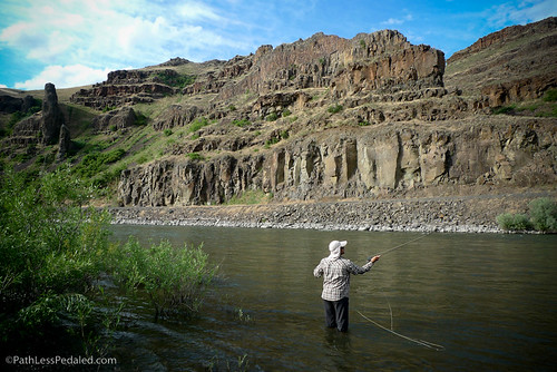
We were so enamored of Joseph and Wallowa Lake that we decided to stay for a few days. I quickly decided that Joseph is my “perfect” small town – great food, lots of art, an independent hardware store, farmers market, all set against an incredible backdrop of snow-covered mountains. Russ reveled in the fishing, catching four trout in one day. We explored and got a bit lost trying to take the “back” way from town to the park. And we were “adopted” by a baby bird that had fallen out of the tree and kept hopping over to our campfire.
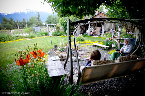
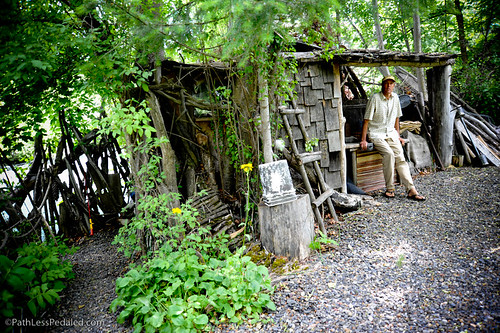
After a restful few days in Joseph (and a perpetual quest for decent Internet service), we headed just a few miles north to Enterprise, to meet Dan & Lynne Price. We had a wonderful time with them, talking about travel and simplicity. Dan graciously welcomed us into the Meadow and gave us a tour of his incredible little homestead, all built by hand from reclaimed materials, in a way that the buildings entirely blend into the landscape. The visit inspired us both, so stay tuned for more stories in a little bit. The other thing had to do in Enterprise, of course, was check out the Terminal Gravity brewery. We enjoyed some beers and food in their delightful garden, and met two guys (on vacation to the area) who were checking out all the local watering holes by bicycle.
We headed north from Enterprise on Hwy 3. It slowly winds up a gentle grade through ranch land and forest, giving you a few glimpses of Joseph Canyon, until you come to the edge of a very large canyon with the Grand Ronde River at the bottom. We soared down the 10-mile descent, winding around all its twists and turns. At the bottom, we pulled into Boggan’s Oasis, a small restaurant with RV park and cabins. We had heard about Boggan’s many times before reaching it, as tales of their milkshakes have spread far and wide. We stayed in one of their cute little cabins and spent the evening at the river – Russ fishing and me watching.
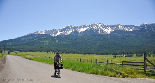
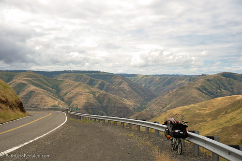
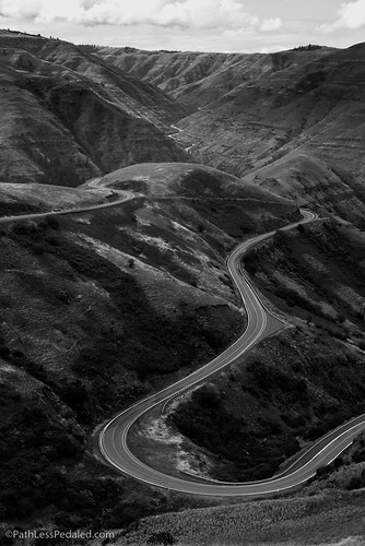
The next morning, we slowly psyched ourselves up for the climb up Rattlesnake Grade. 13 miles to the top, we heard, and 110 turns. We filled up on a hearty breakfast at Boggan’s and then began the climb. As it turned out, it was not nearly as bad as we were expecting. The grade was quite gentle, the traffic was low, and the scenery was amazing. At the top, a black bear ambled across the road, maybe 200 feet ahead of us. And then, around the corner, a coyote trotted across the road as well, making us laugh and joke about a wildlife highway. At the top of the climb, the road straightens out and runs through a high-elevation prairie, dotted with farms. The change in the landscape was so drastic that it startled us and made us, again, glad that we were on bike and able to experiences these changes so fully. Just before the small town of Asotin, the road suddenly pitched downward, and we enjoyed a surprise descent on a smooth and recently re-paved road. After coffee in Asotin, we found our way to Hell’s Gate State Park in Lewiston, Idaho, and enjoyed a quiet evening overlooking the Snake River.
Sounds like wonderful times. The photos are beautiful and yes, it is such an advantage to be on a bike and be able to stop and take it all in. The Price’s place is definitely inspiring. Thanks for posting.
Wonderful stories and stunning pictures! It’s really inspiring to read about your journey, and I love seeing those little Bromptons in such amazing locations — brilliant bikes that just seem to keep getting better. Thanks! 🙂
I was checking in on your blog and see that you’re biking through an area that I will be riding in a bike tour in early Sept.! 🙂 Cool! Your pics are great and I’m looking forward to seeing the area in person! 🙂 Continue to enjoy your trip!! Charmaine
Good to see you made it out to the Wallowas! The Prices are indeed cool. I stayed with them when I bike toured through there last year. Enterprise and Joseph are way off the beaten path, but I hope to make it out there again. Cool to see that you tackled Rattlesnake Grade as well. I almost biked it but got scared off.
So I am waiting for a post about bacon being the perfectest bike touring food ever. I mean I usually don’t carry 100 lbs. with me, but there is almost always some in my panniers. It keeps well, it’s self-greasing, and of course it tastes amazing.
Maybe you guys should take upon yourselves, for the good of the cycle touring community, to do a comprehensive study of different brands and kinds of bacon, and publicise their various merits and detriments as a useful food for cycle tourists.
Or, you could just keep being awesome and have great, inspiring adventures.
Hope all is well.
Bob K.
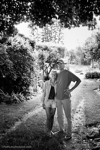
Just catching up on old blog posts I missed, love the b&w switch back pic!